Back جنوب بلاد الشام Arabic Cənubi Levant Azerbaijani Llevant Meridional Catalan شام جنوبی Persian جنوبی سرزمین شام Urdu Nam Levant Vietnamese

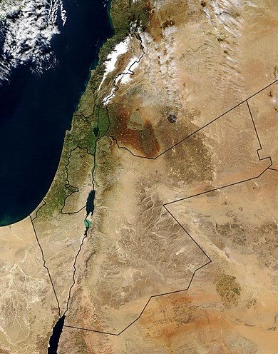
The Southern Levant is a geographical region encompassing the southern half of the Levant. It corresponds approximately to modern-day Israel, Palestine, and Jordan; some definitions also include southern Lebanon, southern Syria and/or the Sinai Peninsula. As a strictly geographical description, it is sometimes used by archaeologists and historians to avoid the religious and political connotations of other names for the area.
Like much of Southwestern Asia, the Southern Levant is an arid region consisting mostly of desert and dry steppe, with a thin strip of wetter, temperate climate along the Mediterranean coast. Geographically it is dominated by the Jordan Valley, a section of the Great Rift Valley bisecting the region from north to south, and containing the Sea of Galilee, the Jordan River and the Dead Sea – the lowest point on the Earth's land surface.
The Southern Levant has a long history and is one of the areas of the world most intensively investigated by archaeologists. It is considered likely to be the first place that both early hominins and modern humans colonised outside of Africa. Consequently, it has a rich Stone Age archaeology, stretching back as early as 1.5 million years ago. With one of the earliest sites for urban settlements, it also corresponds to the western parts of the Fertile Crescent.
© MMXXIII Rich X Search. We shall prevail. All rights reserved. Rich X Search